Brunswick River or Simpsons Creek … Why not both?!
Visiting … or better yet, living in, Brunswick Heads is simply a water-lover’s dream.
It’s framed on the east by sandy white beaches and infamous surf breaks – from Torakina Beach and the break walls at the mouth of the River in the north – stretching south, uninterrupted for 10km past Main Beach and Tyagarah Beach to Byron Bay.
But the surf and sand at this popular, yet quiet Northern Rivers destination are not all that beckon a true water baby. River, creek and surf converge in the perfect aqua-trifecta for those looking to fish, swim, snorkel, paddle, surf, dive, bird-watch, paint … and so much more. To save you time, so you can jump right in, we’ve done the “difficult” job of exploring both waterways!
Brunswick River
Also known as Durrumbil to the Bundjalung of Byron Bay – Arakwal Bumberlin people, Aboriginal Traditional Custodians of the Byron Bay area.
It’s picture-perfect year-round, with recreation and watersport opportunities abounding.
The southern banks of the Brunswick River are dotted by a series of family-friendly parks, framing the main village streets.
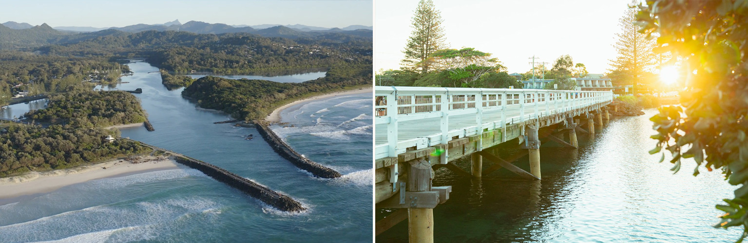
There’s a small marina for fishing boats and small water craft. This is the perfect spot to jump in the tinny or kayak, to explore this turquoise waterway teeming with aquatic life. On the north bank of the Brunswick River is a protected rainforest with Mt Warning providing the hinterland backdrop for spectacular glittering sunsets. The river meanders peacefully from the rock sea walls at the coastline, under the M1 Motorway, winding through dense, fauna-rich bushland, right up to the nearby Northern NSW town of Mullumbimby.
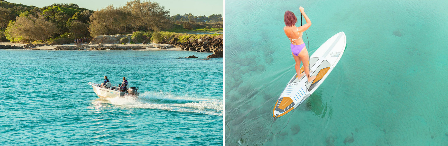
In addition to self-exploring this natural beauty, you can also check out local river cruises, guided kayak tours and stand-up paddleboard tours.
Simpsons Creek
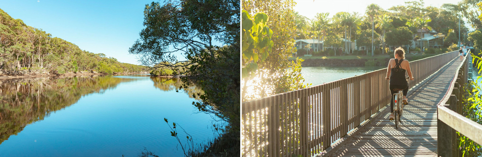
Simpsons Creek is an offshoot of the Brunswick River, framing the eastern boundary of the central streets of this seaside town.
Just south of where the River meets Creek, is the insta-recognisable South Arm Bridge / South Beach Road Bridge. A white timber bridge built in 1937 (upgraded in 2020), famous for its age-old rite of passage, where locals and visitors alike throw themselves into the sparkling clear waters below. Year round, you’ll see kids (and … ahem … *big kids) continuing the tradition of leaping from the timber boards into Simpsons Creek (preferably at high tide!).
At high tide, this creek could be mistaken for the crystal-blue tropical waters of north Queensland’s Great Barrier Reef… perfect to grab your preferred floatie and put the feet up to soak up the Northern NSW sunshine. Towards low tide, Simpsons Creek takes on the unmistakable tea stained colour from the surrounding tea trees which stretch south along the creek banks to nearby Tyagarah Tea Tree Lake.
Simpsons Creek is rich with an array of colourful crabs, large and small fish, rays, native birdlife, butterflies and so much more. Explore this waterway by SUP or kayak and be rewarded by a truly peaceful experience. Once you’ve passed the Reflections Caravan Park and head south, you’ll be travelling through sections of the beautiful Wallum site which are be protected and saved for both future generations and fauna – and you will be unlikely to see another human… just an abundance of wildlife.
Register your interest
To be kept up to date with future land releases and sales news for Wallum:
More Wallum News
Read more news stories, or follow our social pages for more Wallum project updates via the links below:

